
An organization with ties to Republican Gov. Lawrence J. Hogan Jr. announced Wednesday that it will seek to overturn the congressional redistricting plan approved by the Democratic supermajority in the General Assembly.
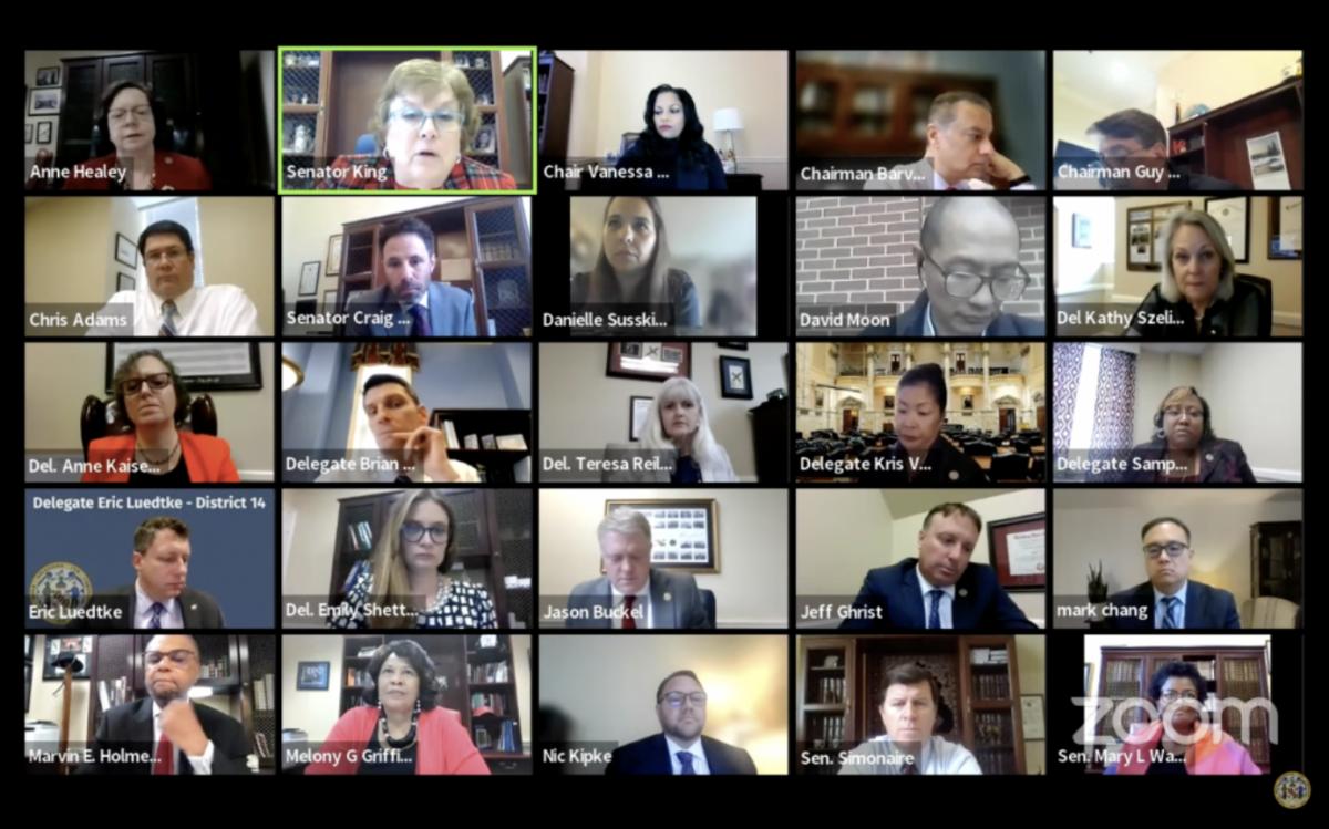
The announcement, from Fair Maps Maryland, came just moments after the state Senate followed the House of Delegates in voting to accept a map drawn by a legislative panel made up of four Democratic leaders, two Republican leaders and a non-voting former top staffer.
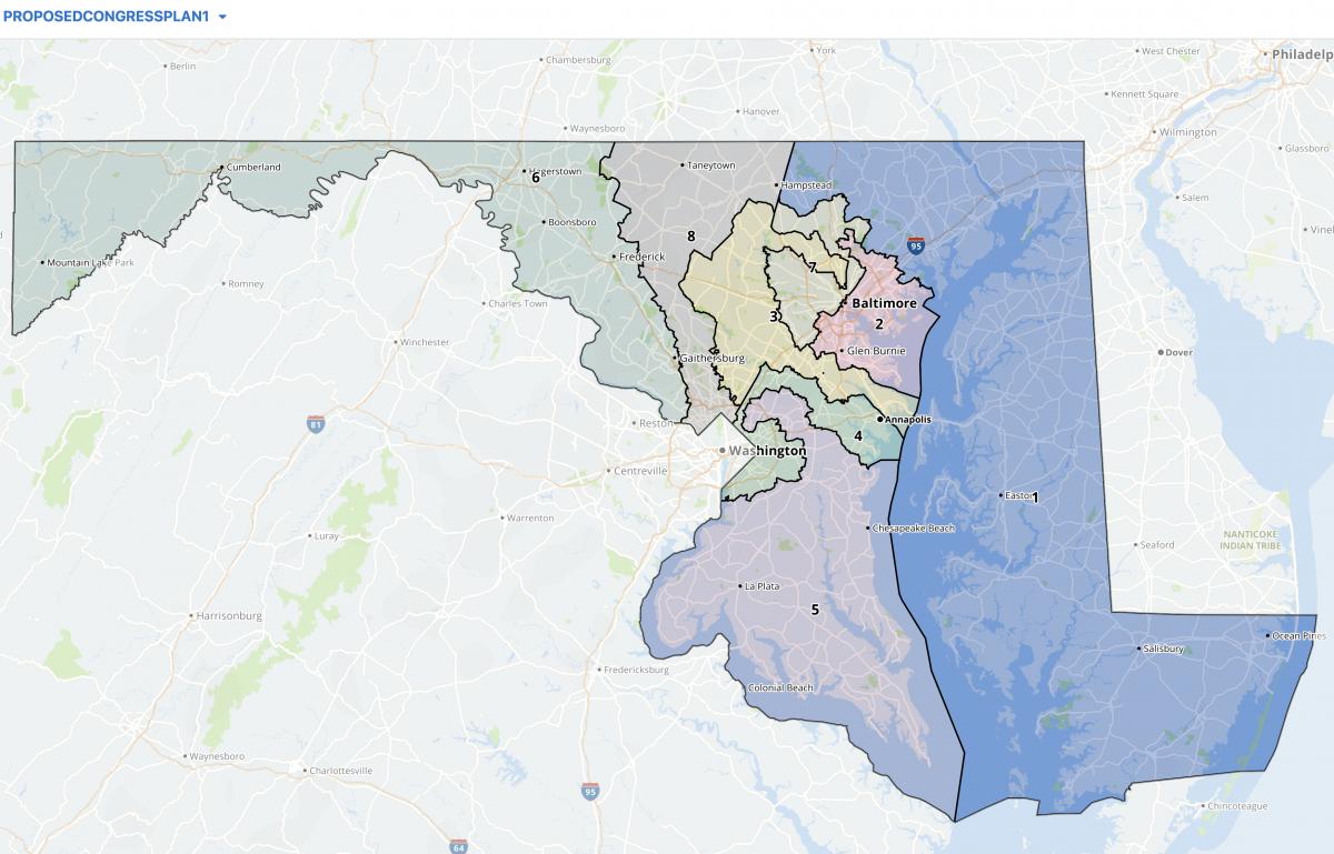
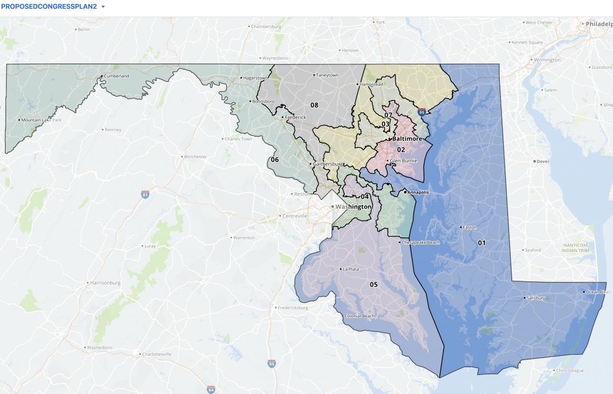
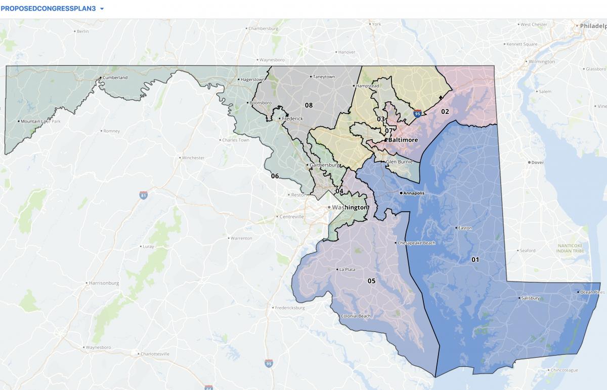
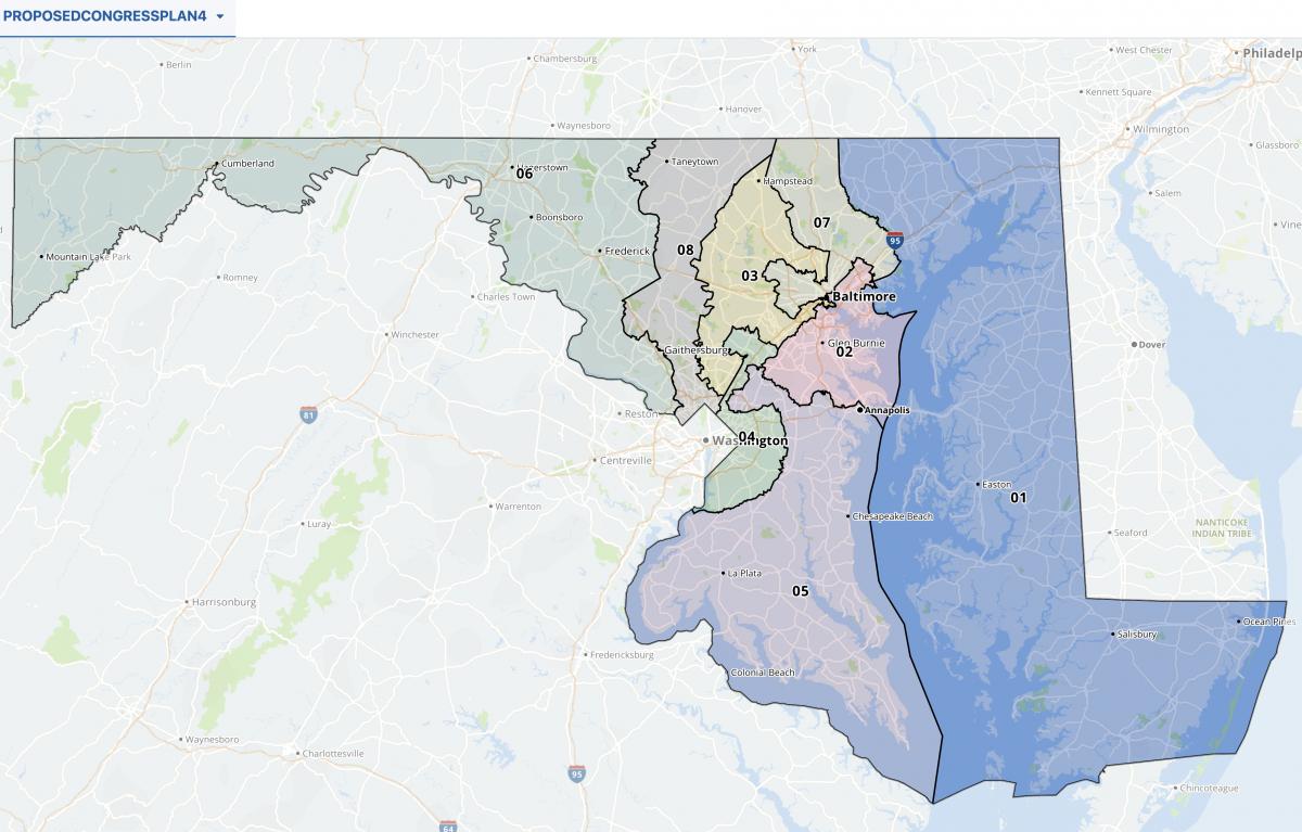
Under that map, crafted by Legislative Redistricting Advisory Committee (LRAC), Democrats would maintain electoral advantages in seven of the state’s eight congressional districts.
Many of those districts would be abstractly shaped, in keeping with the long practice of both parties to maximize the once-a-decade map-drawing process for maximum benefit.
The biggest changes from the state’s current congressional map involve the Eastern Shore-based 1st District, represented by Rep. Andrew P. Harris (R), a Trump-aligned conservative. It was refashioned by the Assembly to pull in portions of Anne Arundel County, giving it a roughly equal number of Republicans and Democratic voters.
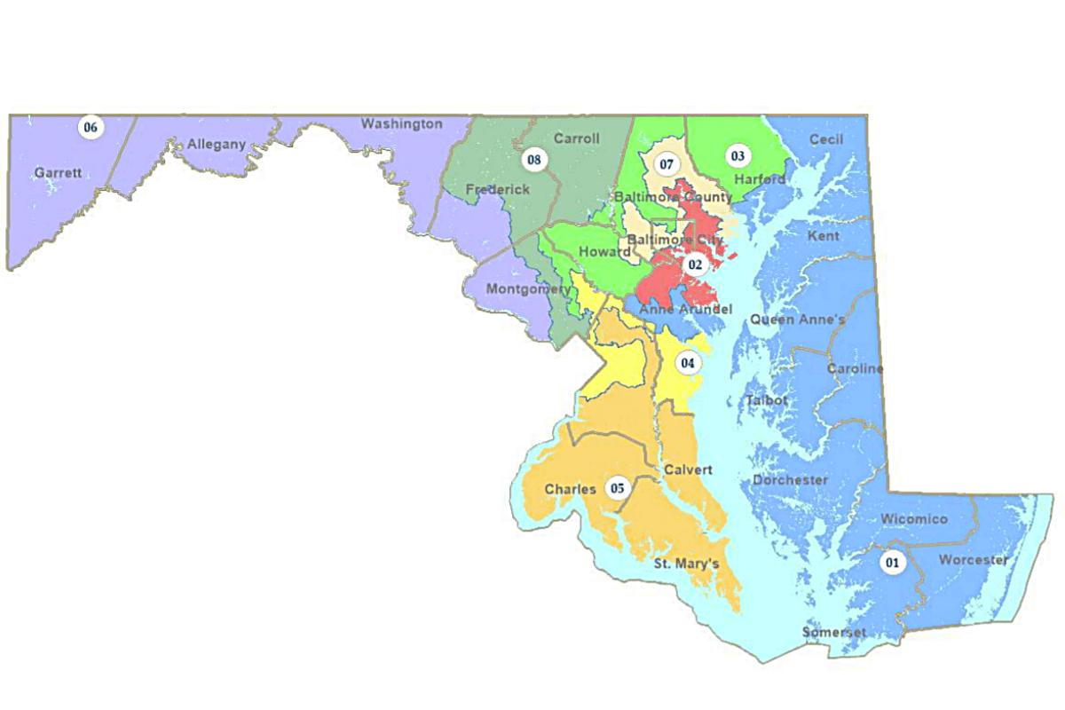
The congressional map adopted by the Legislative Redistricting Advisory Commission. Screenshot from the Maryland General Assembly website.
In announcing its plan to sue, Fair Maps Maryland spokesman Doug Mayer said, “this level of gerrymandering is voter suppression.”
According to Maryland State Board of Elections voter registration statistics, about 55% of Maryland voters are Democrats and 24% are Republicans.
“It’s a sad day in Maryland,” said Mayer, a Hogan strategist and former communications director, in a statement. “The General Assembly has ignored the will of the overwhelming majority of Marylanders.”
He said the organization has hired attorneys to pursue “suits on both the state and federal levels that will prosecute the obvious Voting Rights Act and many other illegal partisan partisan gerrymandering violations.”
Many courts have been reluctant to wade into the politically charged districting process — and while Maryland’s districts may be ungainly, success in court is far from guaranteed.
“A lot depends on how willing courts are going to be to create new causes of action and how — I’ll be frank — how politicized the courts are,” said Michael Li, senior counsel for the Brennan Center’s Democracy Program. “Some courts are more willing to be honest brokers and some are very partisan.”
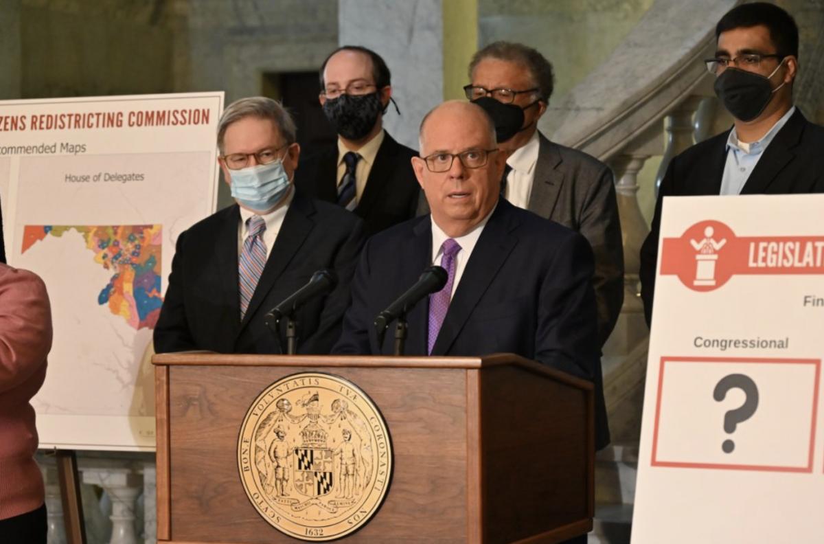
In January, Hogan created the Maryland Citizens Redistricting Commission (MCRC), made up of three Republicans, three Democrats and three independents. Lawmakers held a hearing but didn’t vote on the panel’s proposal, and rejected GOP amendments to replace the legislature’s map with the MCRC proposal.
Because Democrats have long had lopsided advantages in both chambers of the legislature, it has been a forgone conclusion for years that they would have the votes to do as they please when the once-a-decade process of redrawing the state’s congressional districts rolled around.
Cognizant of that reality, Republicans in the General Assembly have been plotting their post-session strategy for some time. Their hope is to find something in the LRAC map that violates state or federal law.
In an interview on Tuesday, House Minority Leader Jason C. Buckel (R-Allegany) conceded that the Supreme Court’s refusal — in Benisek vs. Lamone — to strike down Maryland’s 2011 redistricting plan creates challenges.
“Under the Benisek decision, you don’t really have partisan gerrymandering claims in federal court that are cognizable under the Equal Protection Act or other clauses,” he said. “But I think it’s an open question whether you do under Maryland law — under our free and fair elections clause, which really has never been interpreted in this context.”
Sen. Michael Hough (R-Frederick) suggested attorneys will consider asking the Maryland Court of Appeals to apply the requirement that state legislative districts be compact to congressional districts, a strategy that gerrymandering foes have pursued successfully in other states.
“That happened in Pennsylvania and North Carolina,” he said. “They basically took the constitutions of those states and applied them to the federal maps. If they used the state standards of continuity and compactness, that would be your best case of getting in front of a state court.”
“The federal courts aren’t going to get involved,” he predicted.
Buckel also conceded that race-based challenges under the federal Voting Rights Act are unlikely to succeed. “It tends to neither unduly pack [voters of color] so you’re isolating them… and they’re also not cracking those communities,” he said of the map lawmakers approved.
At Monday’s public hearing on the dueling redistricting proposals, Del. Kathy Szeliga (R-Baltimore and Harford counties) asked LRAC Chair Karl Aro and a legislative staffer to disclose who guided them through the map-drawing process.
“Someone had to put their finger on the mouse,” the former House minority whip said. “Who did that?”
“We have various staff,” senior legislative analyst Michelle Davis replied.
In an interview, Szeliga said Republicans will seek to determine, through litigation, the motives used to craft the legislature’s map.
“Everything that they said in that hearing, I’m sure there will be depositions that will further investigate what the people [in the Department of Legislative Services] did to create these maps,” she said.
“We will find out about the computer program they used,” Szeliga added. “We will find out who clicked the mouse.”
By Bruce DePuyt