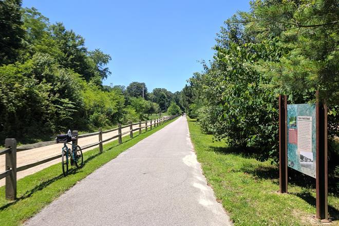


The Easton Rails-to-Trails opened in 1998 with a nearly 3-mile trail spanning most of Easton running north to south. The trail has been a popular spot for walking, jogging, biking, and sightseeing.
The trail provides access to local stores, parks, destinations, and schools. The original railroad station (converted into Town of Easton offices) is near the midpoint of the trail near Goldsborough Street.
Parking for the trail may be found in Idlewild Park (115 Idlewild Ave). Bike or walk two blocks east from the park to access the trail. Parking is also available next to the Talbot County Public Schools building (12 Magnolia St.) and the North Easton Sports Complex (1078 N. Washington St.)
Over the years, the town has added a western spur that goes to Easton Point and recently celebrated the opening of the Easton Village portion of the trail, which includes a footbridge across the Tred Avon River connecting Easton with new housing developments to the west.
Additional plans include building a small parking lot for the trail in Waterside Village, near the St. Michaels road traffic signal. When complete, there will be five and a half miles of trail in the town of Easton.
Note: All Town of Easton parks are open sunrise to sunset.
Town-of-Easton-Rail-Trail-System
Laura Zagon says
Somebody please tell me how one gets to the trail that extends west off the north south trail. I have biked the n-s part zillions of times but have never seen an extension just past Idlewild Road that goes west.
Andrew says
You can’t right now. The “phased” portions are planned – not complete.
Tim says
Is this worth a 4 hour car ride, and $20.00 in tolls?
stephanie says
It would depend on what you want out of it. If you’re looking for a cycling trail, yes as there’s connection to the D&L which extends for about 30+ miles south (I’m not exactly sure) and at Easton swings West until it reaches Allentown. As for any other attractions I’m not the one to say as my own personal experience is primarily with cycling there.
Jenna says
Where is the bridge that goes over Tred Avon??I’ve been on this trail many times and have never seen a bridge.
Marion Arnold says
Does the Town of Easton have a little better map indicating how to access one trail leg from another? The satellite view in this article is not clear. What are the Phase completion dates?
Frederick K Getz says
No state identifier. Does anyone read these b4 they are posted nationally? I am not going to research other local names to find answer.
Ezra Finkin says
It is very difficult, almost impossible, to access the Easton Village trail by foot from points East of the bypass. You either need to take you life in your hands by crossing the Parkway where there is no protected pedestrial crosswalk or drive to walk a 1 mile trail. Is a protected cross walk in the works?