MENU

Sections

  • Home
  • About
    • Contact Us
    • Editors and Writers
    • Join our Mailing List
    • Letters to Editor Policy
    • Advertising & Underwriting
    • Code of Ethics
    • Privacy
    • Talbot Spy Terms of Use
  • Art and Design
  • Culture and Local Life
  • Public Affairs
    • Ecosystem
    • Education
    • Health
    • Senior Life
  • Community Opinion
  • Sign up for Free Subscription
  • Donate to the Talbot Spy
  • Cambridge Spy

More

  • Support the Spy
  • About Spy Community Media
  • Advertising with the Spy
  • Subscribe
June 19, 2025

Talbot Spy

Nonpartisan Education-based News for Talbot County Community

  • Home
  • About
    • Contact Us
    • Editors and Writers
    • Join our Mailing List
    • Letters to Editor Policy
    • Advertising & Underwriting
    • Code of Ethics
    • Privacy
    • Talbot Spy Terms of Use
  • Art and Design
  • Culture and Local Life
  • Public Affairs
    • Ecosystem
    • Education
    • Health
    • Senior Life
  • Community Opinion
  • Sign up for Free Subscription
  • Donate to the Talbot Spy
  • Cambridge Spy
Op-Ed

Commentary: Numbers That Tell Political Stories in the 1st District by Josh Kurtz

September 21, 2021 by Maryland Matters

Now that the General Assembly’s redistricting commission has begun meeting, even as Republican Gov. Lawrence J. Hogan Jr.’s redistricting commission continues to hold sessions, it feels a little like the varsity team has finally taken the field. With all due respect to the other redistricting commissioners.

Hogan will attempt to get as much political mileage as he can from the Maryland Citizens Redistricting Commission he assembled earlier this year, and whatever maps the commission proposes for Congress and the state legislature will undergird Hogan’s bully pulpit when he argues, yet again, that partisanship needs to be taken out of the redistricting process.

The Hogan commission itself has been a bit of a masquerade — both the notion that its work product would result in maps that actually get due consideration in the General Assembly, along with the fiction that this has really been a non-partisan effort, when one of the co-chairs, Walter Olson, a senior fellow with the right-wing Cato Institute, has been calling most of the shots. It’s the legislature’s commission that’s going to produce the congressional and legislative boundaries that get adopted — unless and until the maps get taken to court.

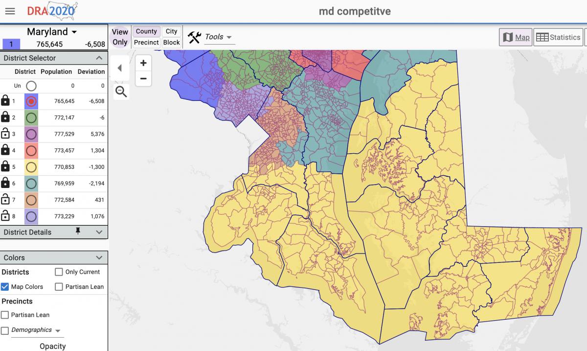
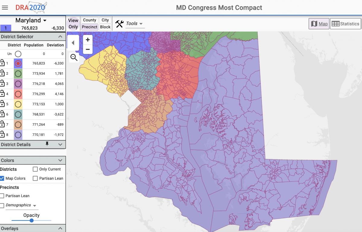
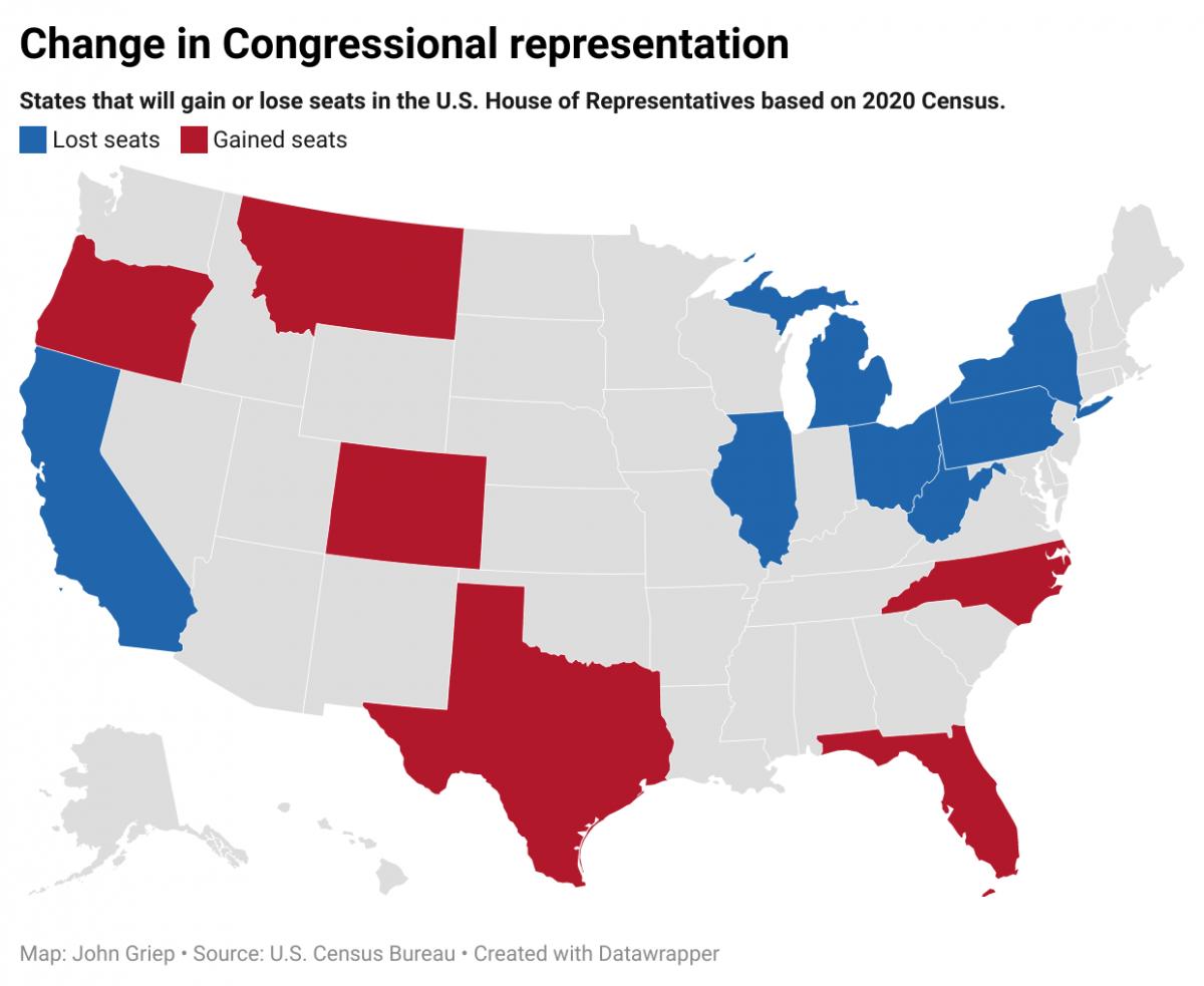
With the Democrats firmly in control of the process for now, the big question is whether they will attempt to draw an 8-0 Democratic congressional map, potentially sending Republican Rep. Andrew P. Harris into political oblivion, or whether they will keep it at 7-1 but generate a cleaner-looking product.

The draft map that the Hogan/Olson commission circulated earlier this month appeared to have five solid Democratic districts, two Republican districts, and one that theoretically could be up for grabs. That more or less accurately reflects the state’s political makeup.

But when has that ever been a consideration during redistricting — here or in the other states where one political party controls the process? And why should Maryland Democrats “disarm” when Republicans aren’t going to do so in Texas, Florida, North Carolina, Wisconsin, Michigan and Pennsylvania? It may be the right thing to do but it isn’t the smart thing to do in the current national political environment.

According to sources on Capitol Hill and here in the Free State, no less an eminence than U.S. House Speaker Nancy Pelosi (D-Calif.) has been brandishing a proposed Maryland map that shows Democrats with eight seats and Republicans with zero. She is touting it to her Maryland colleagues, urging them to embrace the idea, fully aware that are very few states where Democrats can take advantage of redistricting. In fact, national political analysts say that Republicans could take over control of the U.S. House in 2023 on redistricting gains alone — never mind whatever seats they’ll invariably pick up in the midterm elections.

Drawing an 8-0 Maryland map in favor of the Democrats, believe it or not, isn’t that difficult as a cartographic and statistical exercise. The resistance comes from the Democratic members of Congress themselves, who are often reluctant to give up safe territory even if doing so would help the partisan cause.

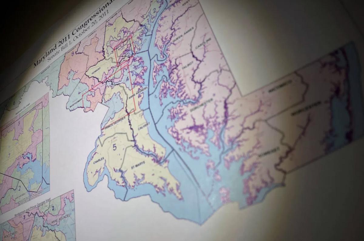
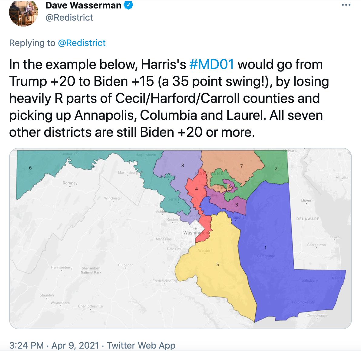
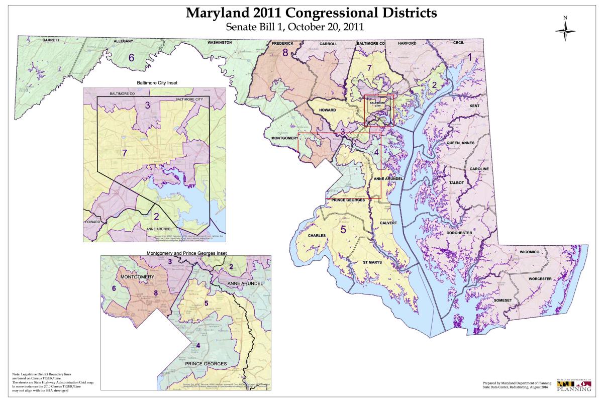
A quick look at the 2020 election results suggests that each of the seven Democratic House incumbents from Maryland have plenty of safe territory to sacrifice: Rep. Anthony G. Brown, whose 4th District includes Prince George’s and Anne Arundel counties, won by 59 points last November; Rep. Kweisi Mfume, whose 7th District is anchored in Baltimore City but also takes in territory in Howard and Baltimore counties, won by 43 points; Rep. John P. Sarbanes, whose hideous-looking 3rd District touches five jurisdictions, won by 39 points.

Those bulging margins were followed by Rep. Steny H. Hoyer’s 38-point victory in the 5th District, which covers the three Southern Maryland counties plus Prince George’s and a piece of Anne Arundel; Rep. Jamie B. Raskin’s 36-point win in the 8th District, which is based in Montgomery but also takes in Frederick and Carroll counties; and Rep. C.A. Dutch Ruppersberger’s 35-point victory in the 2nd District, which touches Baltimore City and Baltimore and Harford counties.

Even in what’s seen as the closest thing to a competitive district in the state, the 6th — the district Democrats specifically carved out in Montgomery County and Western Maryland after the 2010 Census to pick up an extra seat — Rep. David J. Trone won by 16 points last year.

Imagine if each of these guys, minus Trone, said, “I’d be willing to shave 20 points off my victory margin.” How much easier would it then be for Democrats to put Harris’ seat in danger? Harris won reelection, by the way, by 27 points last year.

Our appointed General Assembly

When Cheryl S. Landis is sworn in as the next delegate from District 23B in Prince George’s County sometime this fall, she’ll become the 33rd member of the House of Delegates who was originally appointed to their seat. This is about one-quarter of the 141-member chamber.

And the numbers are certain to grow, with Del. Michael E. Malone (R-Anne Arundel) set to resign soon to take a judgeship, and Del. Erek L. Barron (D-Prince George’s) awaiting U.S. Senate confirmation to become Maryland’s U.S. attorney. Their slots will have to be filled as well.

The numbers aren’t any better in the Senate: In all, 12 of the 47 senators were originally appointed to their seats — five since the 2018 election alone. Add to that two senators who first entered the legislature as appointees to the House.

For those who need reminding, legislative vacancies in Maryland are filled by the governor, usually after receiving a recommendation from the relevant Democratic or Republican central committees in a departed lawmaker’s county. For Landis, it was probably pretty easy to get the recommendation: She’s the chair of the Prince George’s Democratic Central Committee. Several other appointees got their starts in politics serving on a central committee, which greased the skids for their appointment to the legislature.

Some lawmakers have tried to change the system, introducing legislation to require special elections to fill House and Senate vacancies in the first two years of the legislative term. The bill has passed the Senate in the past two years, and unanimously last year, but has stalled in the House.

It’s time to pass that bill. Is this the people’s legislature, or is it the province of political bosses and insiders?

In the meantime, we’d probably all better pay closer attention to central committee elections.

Josh Kurtz, founding editor of Maryland Matters, has been writing about state and local politics since 1995.

The Spy Newspapers may periodically employ the assistance of artificial intelligence (AI) to enhance the clarity and accuracy of our content.

Filed Under: Op-Ed Tagged With: appointees, census, commentary, josh kurtz, Maryland, partisanship, politics, redistricting

Mid-Shore Saw Little Population Growth; QA’s County Added 2K Residents, Kent Lost 1K

September 8, 2021 by John Griep

Although Maryland’s population increased nearly 7% between 2010 and 2020, population growth on the Mid-Shore was virtually stagnant. Queen Anne’s County accounted for most of the growth in the last decade; Kent County’s population decline was the highest in the region.

Census population numbers are used to “determine the number of seats each state has in the U.S. House of Representatives and is also used to distribute hundreds of billions of dollars in federal funds to local communities,” according to the U.S. Census Bureau.

The numbers are also used to draw state legislative districts and county-level districts for county council or commission and board of education where those seats are elected by district.

While much of the focus is on the congressional and state legislative districts, the 2020 population figures may require some small adjustments for county-level seats that are elected from districts.

Queen Anne’s County, with 2,000 more residents, likely will require the most adjustments for its county commission and school board seats, depending on where the new residents are distributed. Kent County does not elect members from districts for county commission or school board and will not need to make any adjustments despite losing nearly 1,000 residents.

Mid-Shore public bodies with districts include:

Caroline County — board of education, three districts;

Dorchester County — county council, five districts; board of education, five districts;

Queen Anne’s County — county commissioners, four districts, one at-large; board of education, four districts, one at-large;

Talbot County — board of education, seven districts.

The biggest battles will occur with the congressional and state legislative district maps. Maryland’s current congressional map is considered one of the most gerrymandered in the nation. Gov. Martin O’Malley and Democratic lawmakers packed Democratic areas into a western Maryland district that had repeatedly elected a Republican to Congress. The mapping process following the 201o Census also put more Republicans into the First District, which encompasses the Eastern Shore.

As a result, Maryland’s congressional representation went from six Democrats and two Republicans to seven Democrats and one Republican (the First District’s Andy Harris).

Two redistricting commissions — one appointed by Gov. Larry Hogan and another by Maryland legislative leaders — are already at work on the maps for the congressional and legislative district maps.

The state planning department offers adjusted redistricting data on its website, which also includes a link to a mapping web portal through which anyone may submit proposed redistricting maps for review by the Maryland Citizens Redistricting Commission appointed by Hogan.

Outside groups also have offered maps, with several available to view at Dave’s Redistricting, “a free web app to create, view, analyze and share redistricting maps for all 50 states and the District of Columbia, according to the site.

The website offers five notable maps — most proportional, most competitive, best minority representation, most compact, and least splitting — for congressional, state senate, and state house redistricting plans.

At presstime, the notable congressional maps for proportionality, competitiveness, and compactness would split the Eastern Shore into two districts. The First Congressional District currently includes the entire Eastern Shore from Cecil to Worcester county and portions of Harford, Baltimore, and Carroll counties.

The current most proportional and most competitive congressional map would create a district that includes Queen Anne’s to Worcester county on the Eastern Shore, the southern Maryland counties of Calvert, Charles, and St. Mary’s, and a portion of Prince George’s County. That district is seen in yellow below.

The most proportional and most competitive Maryland congressional district maps published thus far would include seven Eastern Shore counties, three southern Maryland counties, and a portion of Prince George’s County. Screenshot from Dave’s Redistricting.

The most compact congressional map has a district that includes Kent to Worcester county, the three southern Maryland counties, and portions of Prince George’s and Anne Arundel counties. That district is seen in light purple below.

The most compact Maryland congressional district maps published thus far would include eight Eastern Shore counties, three southern Maryland counties, and portions of Prince George’s and Anne Arundel counties. Screenshot from Dave’s Redistricting.

The Spy Newspapers may periodically employ the assistance of artificial intelligence (AI) to enhance the clarity and accuracy of our content.

Filed Under: 2 News Homepage Tagged With: census, congressional, county, districts, legislative, maps, Maryland, mid-shore, population, redistricting, school board

It’s Map Drawing Time. Citizens Redistricting Commission Opens Public Submissions

September 3, 2021 by Maryland Matters

Marylanders can now submit their own proposals for redistricting to the Maryland Citizens Redistricting Commission, state officials announced Thursday.

The Maryland Department of Planning’s new submission portal allows users to map their proposals for congressional and state legislative districts, and includes instructions on how to draw districts.

Members of the Maryland Citizens Redistricting Commission will review maps that are received by noon on Sept. 24, according to the planning department. More submissions will be accepted when that panel begins its third round of hearings in October.

The map submission portal uses redistricting data which counts incarcerated Marylanders as residents of their last known address, as required by Maryland law, according to the release.

The nine-member commission — which includes three Democrats, three Republicans and three unaffiliated voters — is set to start a new round of public hearings on Sept. 9. That hearing will be virtual.

The commission worked with Stanford Law School professor Nathaniel Persily to hash out some rough criteria for maps on Wednesday. Although the commission won’t make its redistricting proposal for some time and will consider citizens’ proposals, members said they hope to have some early drafts ready for public comment by next week.

Commission members also mulled whether to keep the Eastern Shore whole or cross the Chesapeake Bay to create a district consisting of part of Southern Maryland and the Lower Shore. Commission Member Kimberly Rose Cummings (R), a Dorchester County resident, noted that some Lower Shore residents told panelists, during an initial round of public hearings, that they have more in common with Southern Maryland residents than with residents of north and central Maryland.

There is historical precedent for crossing the Chesapeake Bay in a congressional district, as the state’s 1st Congressional District once included portions of Southern Maryland as well as the entire Eastern Shore from the early 1970s to the early 1990s. The 1st District currently includes all of Maryland’s Eastern Shore and portions of Baltimore, Harford and Carroll countries.

Commission Co-chair Alexander Williams Jr. (D), a Prince George’s County resident and retired federal judge, said that rapidly developing Charles County has more in common with parts of Prince George’s County than with other parts of Southern Maryland. Commission members chose to leave both options on the table for public comment and map submissions.

As for drawing a district in Western Maryland, commission Co-chair Walter Olson (R) said the panel should look to include Carroll County with Frederick, Garrett and Allegany counties. Olson and Williams served on an emergency commission to redraw the state’s 6th Congressional District before the Supreme Court reversed a 2018 order to redraw the district. Olson said that, during the emergency commission’s run, Carroll County residents “overwhelmingly” asked to be included in a Western Maryland district.

Whether the Western Maryland district would draw from portions of northern Montgomery or Howard counties remains an open question for commission members.

None of the commission’s initial criteria are set in stone, rather they are meant to be a baseline for public comment during upcoming public hearings.

Gov. Lawrence J. Hogan Jr. (R) created the Maryland Citizens Redistricting Commission via executive order to draw congressional and legislative maps that he will propose to the General Assembly. Democrats hold a veto-proof majority in both the House of Delegates and the Senate, and lawmakers will have the final say over the state’s next set of maps.

Senate President Bill Ferguson (D-Baltimore City) and House Speaker Adrienne A. Jones (D-Baltimore County) created their own bipartisan redistricting commission, the Legislative Redistricting Advisory Commission, to draw congressional and legislative maps. The legislative commission held its first meeting this week and is set to kick off a statewide round of public hearings on Sept. 20 with a hearing focused on Prince George’s County.

By Bennett Leckrone

The Spy Newspapers may periodically employ the assistance of artificial intelligence (AI) to enhance the clarity and accuracy of our content.

Filed Under: Maryland News Tagged With: census, commission, congressional, districts, legislative, maps, Maryland, redistricting

Legislative Redistricting Commission Promises Transparent Process at First Meeting

September 3, 2021 by Maryland Matters

Maryland’s General Assembly will have the final say over the state’s next set of congressional and legislative maps, and legislative leaders’ bipartisan redistricting commission held its first meeting Tuesday evening.

The Legislative Redistricting Advisory Commission, convened by Senate President Bill Ferguson (D-Baltimore City) and House Speaker Adrienne A. Jones (D-Baltimore County), will conduct public hearings before proposing congressional and legislative maps. Karl Aro, former executive director of the non-partisan Department of Legislative Services, is the commission’s chair.

The Department of Legislative Services will be responsible for drawing maps based on the commission’s input, Aro said. He said the map drafts will be confidential until the commission is ready to release its proposal to the public.

Jodie Chilson of the Department of Legislative Services said that any member of the General Assembly will be able to request a map be drawn.

“Any request that comes to us for that would be confidential even with respect to the commission,” Chilson said. “Once the map is drawn and you get it, you can do with it what you want, but as we’re drawing it that would be confidential.”

The departments of Planning and Legislative Services finalized data to be used for redistricting on Tuesday, Legislative Services Senior Policy Analyst Michelle Davis told members of the panel. The U.S. Census data used for redistricting was released last month, but state officials needed to adjust that data to comply with Maryland law, which requires that incarcerated people are counted as residents of their known address. She said that data will be available to the public soon.

Senate Minority Leader Bryan W. Simonaire (R-Anne Arundel), a member of the panel, pressed for a bipartisan map-drawing process, and said he hopes commission members work together when it comes to creating a single, cohesive map.

“We’re not in the majority and don’t pretend to be there, but I would like to be included as opposed to Republicans going off and doing their maps, Democrats going off and doing their maps,” he said.

Simonaire noted that after the 2010 Census, Gov. Martin O’Malley (D) created a redistricting commission to conduct public hearings, but according to depositions from the Benisek v. Lamone case, most map-drawing during that process was done away from the public eye by political operatives and incumbents.

“We ended up with some of the worst maps in the nation … especially on the congressional side,” Simonaire said.

Aro said he hopes the legislative commission will produce a map that makes people feel that their communities are largely kept whole, but warned that some areas will likely have to be split due to how complex the process is. He likened redistricting to “doing brain surgery with a sledge hammer.”

“My hope too is that the geography will look, for lack of a better word, prettier,” Aro said. “It should. I imagine we’ll just have to work our way through it.”

Ferguson said public input will be “absolutely essential” to the commission’s work and pledged a transparent process.

“We will have a fair and transparent process, and in order for that to happen we need to hear from the public,” Ferguson said.

Jones likewise underscored the importance of public input.

“For those Marylanders watching this online, we are asking you to show up at our hearings, write us letters, and send us your ideas,” Jones said. “We are listening.”

Jones also acknowledged that the redistricting debate likely won’t end when the General Assembly adopts maps.

“There’s a good chance that these maps will end up in court,” she said. “That is the nature of redistricting. We will follow the advice of counsel at every step, making sure that the rights of all Marylanders are protected.”

The Legislative Redistricting Advisory Commission will conduct region-based and statewide public hearings in the coming months, and will kick off with a public hearing in Prince George’s County on Monday, Sept. 20. The location of that meeting wasn’t immediately available, but the meeting will be live streamed.

Other lawmakers on the commission are Senate President Pro Tempore Melony Griffith (D-Prince George’s), House Majority Leader Eric Luedtke (D-Montgomery) and House Minority Leader Jason Buckel (R-Allegany).

The Legislative Redistricting Advisory Commission is one of two panels tasked with conducting public hearings and drawing up a proposed set of congressional and legislative maps in the coming months: Gov. Lawrence J. Hogan Jr. (R) created the Maryland Citizens Redistricting Commission earlier this year to create maps that he will propose to the General Assembly.

That commission includes three Republicans, three Democrats and three unaffiliated voters, and completed one round of public hearings before the release of U.S. Census data in August.

Hogan plans to introduce both the congressional and legislative maps that are drawn by the Maryland Citizens Redistricting Commission. The governor is required to introduce legislative maps, but statutes are silent on who is responsible for introducing congressional maps. The General Assembly is allowed to make changes to those maps and draw their own.

While both commissions are tasked with drawing up maps, the ultimate authority for mapmaking in Maryland rests with the General Assembly, where Democrats hold a veto-proof majority in both the House of Delegates and the Senate.

Hogan can veto only congressional maps, although lawmakers easily overrode his vetoes on such measures as police and education reform during the 2021 legislative session. He can’t veto the General Assembly’s legislative maps, but his proposed maps would become law if the General Assembly doesn’t pass a redistricting plan within the first half of the 2022 legislative session.

At a media briefing ahead of the legislative panel’s first meeting Tuesday, Simonaire and Buckel reiterated their support for Hogan’s Maryland Citizens Redistricting Commission.

“The best way to do redistricting is in a bipartisan or nonpartisan fashion, letting the citizens drive the redistricting process rather than the politicians in the back room,” Buckel said.

Simonaire previously predicted that the legislative commission’s final vote would come down to a party-line split. He said Tuesday that he remains “skeptical” of the legislative redistricting commission.

Congressional maps could be adopted by the General Assembly later this year, with legislative leaders considering a special session in December to tackle congressional redistricting.

By Bennett Leckrone

The Spy Newspapers may periodically employ the assistance of artificial intelligence (AI) to enhance the clarity and accuracy of our content.

Filed Under: Maryland News Tagged With: census, Congress, general assembly, maps, Maryland, redistricting

Analysis: Census Data and the Political Reordering to Come in Md.

August 16, 2021 by Maryland Matters

Baltimore City leaders knew they were coming.

And yet, the newest population numbers from the U.S. Census, delivered Thursday on the hottest day of the year, hit them like a torrent of cold water in the face.

Baltimore’s dramatic 5.7% population loss over the past 10 years means the city is sure to face a corresponding loss of political clout in the decade ahead — no matter how many allies it has in the highest echelons of power in Annapolis.

That’s one of many political threads that will be pulled over the next several months, as state politicians and policymakers seek to use the Census data as part of the recipe for congressional and legislative district maps that will be in place until the elections of 2032.

Baltimore wasn’t the only Maryland jurisdiction to see significant population losses — far from it. But the latest numbers did produce a significant degree of handwringing in the city.

Donald C. Fry, president and CEO of the business group the Greater Baltimore Committee, called it “unacceptable for a city with the many positive attributes Baltimore has, from its affordability, diversity, strong neighborhoods, historical and cultural attractions to world class healthcare and universities, to lose residents.”

Baltimore Mayor Brandon M. Scott (D) scrambled to put the dreary numbers in historical context and asserted that city leaders are putting policies in place to stanch the bleeding and slowly build back the city’s population.

“Today’s population figures are the culmination of more than 70 years of population decline, showing why we must pivot from the status quo towards inclusive economic policies that improve the lives of our legacy residents, while attracting new residents,” Scott said Thursday. “Understanding that much of Baltimore’s 21st century population loss has been driven by an exodus of African American households, my administration will be focused on equitable economic development. We can no longer leave any corner of our city behind.”

Census figures help determine how much federal aid is distributed to states and local jurisdictions, but they are also key weapons in the raw redistricting political battles that will follow.

Overlaying Maryland’s current congressional and legislative district maps with the map of of the latest county-by-county population trends is an interesting exercise.

Even the most gerrymandered political maps must start at the corners of the state — far Western Maryland and the Lower Eastern Shore. And at both poles of the state, the population, with the exception of Wicomico County on the Shore, has declined over the past decade. That’s part of a national trend that saw rural population drop sharply while it increased in urban and suburban areas — and will have implications for what congressional and legislative boundaries in Maryland look like.

From the minute he took office, Gov. Lawrence J. Hogan Jr. (R) has sought to inject himself in the redistricting process — or at least take the power away from the Democratic supermajorities in the General Assembly and, by extension, the most senior Democrats in the state’s congressional delegation. But the fact remains that legislative leaders, working in tandem with U.S. House Majority Leader Steny H. Hoyer (D-Md.), will have the most say.

For State House Democrats, knowing that Republican legislatures will attempt to help the GOP seize control of the U.S. House of Representatives by muscling through baldly gerrymandered maps, there will be temptations to create an 8-0 Democratic congressional map in Maryland (the state delegation currently has seven Democrats and one Republican). But the Census figures show that population trends in certain red states weren’t as stark as they could have been — meaning Republicans won’t have quite as much power to bludgeon Democrats in those places as they might have expected.

“Early read: based on the strong urban and weaker rural numbers I’m seeing, this is a much more favorable Census count than minority advocacy groups/Dems had feared,” Dave Wasserman, the House analyst for the nonpartisan Cook Political Report tweeted Thursday.

As a result, Maryland Democratic strategists believe, party leaders are more likely to try to produce a 7-1 Democratic congressional map again — albeit one that is cleaner, with fewer tortured contours, and that is less susceptible to lawsuit than the post-2010 Census map.

Baltimore City currently has three congressional districts cutting through its borders. Anne Arundel County has four. Howard County has three. Baltimore County has four. The result is messy, nonsensical districts in the central part of the state. That may change.

With population losses on the Eastern Shore, the 1st Congressional District, held by the state’s lone Republican member of Congress, Rep. Andrew P. Harris, will probably need to gain more territory on the western side of the Chesapeake Bay. Where those precincts are added may determine how competitive a re-election race Harris will face in 2022 — most likely against former state Del. Heather R. Mizeur (D).

Maryland mapmakers actually have more flexibility when it comes to drawing legislative districts — where population variations of as much as 10% are permissible (each congressional district must contain the exact same population, to the extent possible). Even so, Baltimore City, which has steadily lost representation over the past few decades, is likely to lose more seats.

It’s already accepted wisdom in Annapolis that the 44th District, which currently contains a one-member House subdistrict in Baltimore City and two House seats in Baltimore County, will push out into the county exclusively — meaning the legislative tenure of Roxane Prettyman (D), who has been recommended by the Baltimore City Democratic Central Committee to fill a vacancy in District 44A, could be short-lived.

Another Baltimore City legislative district that has seen modest population growth, District 46, may have to lose some city precincts to make whole other city districts — and could extend south toward Glen Burnie or even BWI Thurgood Marshall Airport.

Howard County’s population growth means it may no longer have to share one legislative district with Baltimore County. Frederick County’s population growth means it may not have to share a legislative district with Carroll County. Southern Maryland’s representation in Annapolis is also likely to grow — though Democrats undoubtedly will try to maximize their advantage in fast-growing Charles County, which, according to the latest Census figures, is now over 50% Black.

And population losses in Garrett and Allegany counties mean the 1st legislative district will necessarily have to push farther east into Washington County.

The Maryland Department of Planning will now take the Census figures and spend the next few weeks adjusting them to account for the state’s incarcerated population. Under state law, incarcerated individuals are countered as residents of the jurisdictions where they previously lived, rather than the jurisdiction of the prisons where they are serving their sentences. This could help limit Baltimore City’s population loss to a small degree.

Hogan and legislative leaders are relying on the work of dueling redistricting commissions to help guide them on the maps they will propose in an upcoming special session of the General Assembly to finalize a congressional map, and during the regular 2022 session when legislative lines must be adopted. Even though Democrats have the upper hand, Hogan was already attempting to grab the moral high ground on Thursday.

“All across our state, Marylanders are demanding an end to partisan gerrymandering from partisan politicians in the legislature and supporting the work of the independent and nonpartisan Maryland Citizens Redistricting Commission,” he said on Twitter.

By Josh Kurtz

The Spy Newspapers may periodically employ the assistance of artificial intelligence (AI) to enhance the clarity and accuracy of our content.

Filed Under: Maryland News Tagged With: 2020, census, congressional, districts, gerrymandering, legislative, Maryland, redistricting

2020 Census Data: Fewer than Half of Marylanders are White, Baltimore Population Slips, Montgomery Surpasses 1M

August 13, 2021 by Maryland Matters

Maryland became more diverse over the last decade and the number of residents who identify as white alone dropped below half the state’s population, reflecting a nationwide trend, according to U.S. Census bureau data released Thursday afternoon.

The state’s overall population increased 7% since 2010, up to 6,177,224 residents in 2020. It is the first time the state’s population has topped more than 6 million residents in a decennial Census.

Montgomery County accounts for about one-sixth of the state population, and became the first jurisdiction in state history to register more than 1 million residents in the Census.

The data released Thursday also confirmed continued population loss in the city of Baltimore. In 1950, the city had just under a million residents — 949,708 — but that figure has been sliding ever since.

There were 585,708 Baltimoreans counted in the 2020 Census.

Here are four takeaways from the data:

Less than half of Marylanders identified as white

Less than half of Maryland’s population now identifies as white alone, according to Census data. The state saw a 10.5% decrease in the number of people who identify as white alone between 2010 and 2020, according to Census data, and that figure now stands at 48.7%.

Every county in the state saw decreases in the number of people identifying as white alone over the past decade.

The percentage of the population identifying as Hispanic or Latino increased from 8.2% in 2010 to 11.8% in 2020.

The percentage of Marylanders identifying as Asian alone increased from 5.5% in 2010 to 6.8% in 2020, and the percentage that identifies as Black or African American alone increased slightly from 29.4% in 2010 to 29.5% in 2020, according to the data.

Those figures reflect increasing diversity across the United States, according to Census data. The percentage of Americans identifying as white alone fell 8.6% nationwide between 2010 and 2020.

Garrett County had the largest white population in Maryland — 95.5% of county residents — while Prince George’s County had the smallest — 12.9%. The percentage of Prince George’s County residents who identify as white alone fell by nearly 25% over the last decade; the county ranks 11th nationwide for its percentage of non-white population, according to the Census Bureau.

Baltimore’s population dropped below 600,000 for the first time in a century

While Baltimore County grew between 2010 and 2020, the city of Baltimore saw yet another decline in population during the last decade.

The city had a population of 585,708 as of the 2020 Census compared with 620,961 in 2010, a 5.7% decrease. The 1910 Census was the last time Baltimore’s population was under 600,000. Baltimore’s population has been in decline since it topped out at 949,708 in 1950, according to the city’s planning department.

In a Thursday news release, Baltimore Mayor Brandon M. Scott (D) said he plans to launch a growth plan for 2030 aimed at improving quality of life in the city.

“Today’s population figures are the culmination of more than 70 years of population decline, showing why we must pivot from the status quo towards inclusive economic policies that improve the lives of our legacy residents, while attracting new residents,” Scott said in a release. “Understanding that much of Baltimore’s 21st century population loss has been driven by an exodus of African American households, my administration will be focused on equitable economic development. We can no longer leave any corner of our city behind.”

Baltimore’s 5.7% population percentage drop wasn’t the most dramatic in the state: Allegany County lost 9.3% of its population between 2010 and 2020, dropping from 75,087 to 68,106.

Somerset County saw a 7% decrease, with its population decreasing from 26,470 to 24,620.

Kent County, Maryland’s smallest by population, saw a 4.9% decrease, dipping below 20,000 to 19,198.

Dorchester, Garrett and Talbot counties also saw population decreases.

Montgomery County tops 1 million residents; Frederick, Howard and Charles saw massive growth

Montgomery County became the first Maryland jurisdiction in history with a population topping 1 million in a decennial census. The county’s official population grew 9.3% in the last decade and now stands at 1,062,061.

Montgomery’s population has more than doubled since the 1970 Census, when there were 522,809 residents.

Frederick County was home to the fastest growth in Maryland, with its population increasing by 16.4% between 2010 and 2020.

Howard County saw a 15.8% increase in its population, and Charles County saw a 13.7% increase.

In all, seven of Maryland’s “Big Eight” counties saw population growth over the past decade.

Prince George’s County’s population grew by 12%; Anne Arundel County saw a 9.4% increase and now has a higher population than Baltimore City at 588,261; Harford County saw a 6.6% increase; and Baltimore County’s population increased by 6.1%.

Southern Maryland’s growth wasn’t confined to Charles County: St. Mary’s County saw a population increase of 8.2% and Calvert County’s population increased by 4.6%.

What does this data mean for redistricting?

The raw, untabulated data released by Census officials Thursday will be used by lawmakers and redistricting commissions across the country for mapmaking — but it will need some adjustments before it’s ready to be used in Maryland’s redistricting process.

Maryland Department of Planning officials will need several weeks to adjust the data to comply with Maryland law and move currently incarcerated people back to their last known address. Once that adjustment is finished, that data will be used by Maryland’s dueling redistricting commissions to draw up proposed congressional and legislative maps.

By Bennett Leckrone, Danielle E. Gaines, and William F. Zorzi.

The Spy Newspapers may periodically employ the assistance of artificial intelligence (AI) to enhance the clarity and accuracy of our content.

Filed Under: Maryland News Tagged With: census, Maryland, population, redistricting

Maryland Will Keep 8 Seats in U.S. House, Census Officials Say

April 27, 2021 by Maryland Matters

Maryland will keep its eight seats in the House of Representatives in the next round of redistricting, Census Bureau officials announced Monday.

Maryland joins 36 other states keeping the same amount of U.S. Representatives during the next round of redistricting.

For six states, the long-awaited census results mean they’ll gain representation in Congress: Fast-growing Texas will add two seats, and five states will each add one seat: Florida (which surpassed New York to become the third-largest state), North Carolina, Colorado, Montana and Oregon.

Because the House must remain at 435 lawmakers, seven states will have fewer representatives, after either losing population over the last 10 years or not growing as quickly as other states. New York, California, Illinois, Michigan, Ohio, Pennsylvania, and West Virginia all will see their federal delegations shrink by one legislator starting in 2023.

Overall, there were 331,449,281 people living in the U.S. on April 1, 2020, an increase of 7.4% since 2010. That’s the slowest growth in a decade since the 1930s, and the second-slowest growth rate in U.S. history.

Maryland had a population of 6,177,224 in the 2020 Census, according to the newly released data, representing a 7% increase since 2010. That’s a drop from the 9% increase the state saw between 2000 and 2010, according to the data.

The apportionment changes, including population totals, are the first round of data to be released from the 2020 census.

Block-by-block population data that state officials need to draw districts of equal size will be released by Aug. 16 as an untabulated “legacy format summary file,” according to a Census Bureau release.

Although that data will be available as a legacy format summary file in mid-August, some states might be faced with an even longer wait for specific results. According to a separate release from the Census Bureau, “most states lack the capacity or resources to tabulate the data from these summary files on their own,” and tabulated data will be available by Sept. 30.

Even after Maryland officials receive the data, it will need to be adjusted to comply with Maryland law and have incarcerated individuals reallocated to their last known address, according to the Maryland Department of Planning website. State officials estimate that process will take at least an additional 30 days before the redistricting data is finalized.

Census officials originally planned to get redistricting data to states by March 31, but that date was pushed back after the COVID-19 pandemic waylaid their counting process.

Those delays could put Maryland lawmakers — and candidates for Congress and the General Assembly uncertain whether they’ll still be living within a district’s boundaries — on a time crunch: While Maryland law doesn’t set a strict deadline for drawing congressional districts, state legislative districts must be proposed by Gov. Lawrence J. Hogan Jr. (R) to the General Assembly by Jan. 12, 2022. Those recommendations will become law unless lawmakers tack on their own changes by Feb. 26.

The candidacy deadline for Republican and Democratic congressional and legislative hopefuls is Feb. 22, 2022.

In 2010, the General Assembly met in a special session in October to approve congressional district lines.

Some states with even tighter deadlines written into law might have to change their redistricting laws to cope with the delays, according to a Brennan Center Analysis.

Hogan’s multi-partisan Maryland Citizens Redistricting Commission, which he created via executive order earlier this year, is currently mulling how to work around the Census delays, commission co-chair Walter Olson (R) told Maryland Matters.

“It’s going to mean that we get hard, usable numbers months later than we would have hoped,” Olson said, adding that working around the Census delay will be among the commission’s top agenda items.

“The goal is to get as much work as we can done, including many hearings, before the Census Bureau comes through,” Olson said.

The redistricting commission, which earlier this month announced its full membership, will conduct public hearings in the coming months before making final recommendations to Hogan. They’ll aim to recommend geographically compact districts that aren’t meant to favor any party over another – and will also consider dividing state legislative maps into single-member districts.

Defending the census process

Typically, the state-level population data released Monday would have been provided by the end of December, but that process was delayed due to the COVID-19 pandemic.

The census tallies how many people are living in the U.S. on April 1, and last year, that date fell shortly after states had issued lockdown orders aimed at curbing spread of the coronavirus. That scrambled plans for following up door-to-door with those who did not fill out the form.

“We advertised on pizza boxes, instead of during basketball games,” said Ron Jarmin, acting director of the Census Bureau. “Our partners joined us in reaching people at food banks and in school cafeterias, instead of promoting the census at county fairs.”

Other Americans became harder to reach due to wildfires and hurricanes. The Trump administration also interfered in the counting process, pursuing policies that some feared would make immigrants less likely to respond and cutting the operation short.

As they announced the new population figures, Census officials defended the accuracy of the counting process, saying the delayed door-to-door follow-ups allowed for more complete responses.

While the final numbers show a slower growth rate than what had been projected, affecting the final allocation of legislative seats, the population numbers for most states were still within 1% of the bureau’s estimates.

Under the new congressional districts, which will go into effect for the 2022 elections, each member of the House will represent an average of 761,000 residents.

The biggest population gains regionally were in the South and the West, with Southern states growing by 10.2% and Western states by 9.2%. The Northeast grew by 4.1%, and Midwestern states showed a 3.1% rise in population.

That followed trends underway since the 1940s, with 84 House seats shifting South and West during that time frame, Census officials said Monday.

By Bennett Leckrone and Laura Olson

The Spy Newspapers may periodically employ the assistance of artificial intelligence (AI) to enhance the clarity and accuracy of our content.

Filed Under: Maryland News Tagged With: 2020, census, House of Representatives, Maryland, redistricting

Could First District Turn Blue? Report Offers Possible Map

April 13, 2021 by John Griep

After turning the state’s Sixth Congressional District blue following the 2010 Census, Maryland Democrats could set their sights on the state’s sole remaining Republican lawmaker, Rep. Andy Harris, during the congressional redistricting that will follow the 2020 Census.

A map drawn by one political analyst shows it would be relatively easy for Democratic state lawmakers to shut out Maryland Republicans from Congress by shifting the boundaries of the state’s eight congressional districts.

David Wasserman, writing in The Cook Political Report (subscription required), said the map would result in a 35-point leftward swing for the First District. The new district would have voted for Joe Biden by 15 points in 2020; current First District voters chose Donald Trump by 20 points in the 2020 presidential race.

Wasserman is House Editor for The Cook Political Report, where he is responsible for analyzing U.S. House races and is recognized as one of the nation’s top election forecasters. He also is a contributor to NBC News.

Maryland’s other seven congressional districts would remain overwhelmingly Democratic with his map, voting for Biden by at least 20 points, Wasserman wrote in his Maryland redistricting preview and on Twitter.

Wasserman developed his map using Dave’s Redistricting App, which allows users to explore congressional redistricting options.

One Democrat who has filed to challenge Harris in the First District noted Wasserman’s analysis, but suggested opposition to such a big change.

On her campaign website, Heather Mizeur, a former state delegate and gubernatorial candidate who lives in Kent County, wrote:

“We don’t want a gerrymandered district. We want a fair district. The right answer in how it gets drawn at the end of the day is somewhere in between these extreme shifts.

“What we know for sure is that the district will be redrawn, it will get more competitive, and we are and will continue to be the campaign best positioned to defeat Andy Harris when it happens.”

The Maryland map currently in use (below) was approved in 2011 using data from the 2010 Census. A legal challenge to that map ended in 2019 when the U.S. Supreme Court ruled that the courts have no role in partisan gerrymandering claims.

Statewide_reduced

Partisan gerrymandering of congressional districts can have dramatic effects on the party control of the House.

In the Atlas of Redistricting, Wasserman and others writing at FiveThirtyEight looked at congressional districts based on several different factors.

Their analysis showed that if districts were gerrymandered to favor Democrats, the party would be expected to have 251 seats in the House compared to 184 for Republicans. If districts were gerrymandered to favor Republicans, the GOP would be expected to have 264 seats to 171 for Democrats.

The U.S. Census Bureau, citing the COVID-19 pandemic, announced in February that redistricting data would be released to all states by Sept. 30, six months later than its April 1 deadline.

The bureau will deliver apportionment counts (which determine how many representatives each state will have) to the president by April 30, four months later than normal. Maryland is expected to maintain its eight seats in the U.S. House of Representatives.

The Spy Newspapers may periodically employ the assistance of artificial intelligence (AI) to enhance the clarity and accuracy of our content.

Filed Under: Maryland News Tagged With: andy harris, census, Congress, congressional districts, david wasserman, gerrymandering, heather mizeur, Maryland, redistricting

Census Data Delay Likely Means No Redistricting Session This Fall in Md.

February 18, 2021 by Maryland Matters

The U.S. Census Bureau’s decision to delay releasing population data until fall almost certainly guarantees that Maryland lawmakers won’t redraw the state’s political boundaries before next year, political analysts said on Tuesday.

The bureau originally planned to get results of the 2020 Census to states by March 31. But officials announced on Friday that they will provide it by Sept. 30 instead.

They blamed the delay on the COVID-19 crisis, which made surveying every household in the country, a labor-intensive process that involves millions of face-to-face interactions, more difficult.

Maryland and other states will use the data — once they get it — to craft congressional and legislative boundaries that will be used for the next five election cycles, beginning with U.S. House and General Assembly contests in 2022.

The delay in receiving population data makes it highly unlikely the legislature will meet in special session this fall, according to three people knowledgeable about the process.

Instead, lawmakers will have to tackle congressional and legislative redistricting when they convene in January for the 2021 session.

There is no way to replicate the more generous timeline that lawmakers had in 2011, said Patrick H. Murray, a former chief of staff for the late Senate President Thomas V. Mike Miller Jr., now the top aide to Baltimore County Executive John A. Olszewski Jr. (D).

For that redistricting, then Gov. Martin J. O’Malley (D) announced a redistricting committee in the summer, the committee drafted a congressional map in early October and the legislature convened a special session to consider it later that month, Murray recalled.

Given advances in computer software since the 2011 redistricting, lawmakers and their staffs won’t necessarily need a lot of time to draw new lines, said Daniel M. Clements, a retired lawyer and longtime Democratic activist who has been involved in past redistricting efforts.

But pitched battles that often occur internally — among incumbent members of Congress and the General Assembly over various precincts — can take time to resolve.

The 2022 primary election is set for June 28. And the deadline for candidates to file is Feb. 22.

Assuming it does not get pushed back, legislators will have less than six weeks to conclude a process that is fraught with political intrigue and where emotions can run hot.

“You will have that piece, but the shorter time means they just have to resolve it quicker,” Clements said.

In January, Gov. Lawrence J. Hogan Jr. (R) created a nine-person redistricting commission to study Maryland’s population changes, take public input and draw a set of boundaries that he can submit to the legislature.

The panel will have three Democrats, three Republicans and three voters who aren’t registered with any political party.

Cato Institute senior fellow Walter Olson, a Republican; retired federal judge Alex Williams, a Democrat; and Howard Community College President Kathleen Hetherington, an independent, will serve as co-chairs.

The other six slots will be filled by a group of applicants who put their names forward prior to the Feb. 12 deadline.

Olson would not disclose the number of people that applied, but he described them as “an impressive and diverse group of applicants.”

The governor’s commission will hold statewide hearings once it is empaneled.

Olson said the delay in Census data compresses the amount of time the panel will have to do their work.

“Our work has to be done later and with somewhat more time pressure than would have been predicted,” he said. “We have our assignment, which is to propose maps for U.S. House [districts] and for the General Assembly. Whether a special session occurs or not is not part of our to-do list.”

Speaking on WBAL Radio, Hogan again slammed Democratic leaders in the General Assembly for how they have drawn lines in the past and for rebuffing his efforts to take line-drawing out of the hands of legislators.

He pledged to submit the commission’s maps as his own, “without any influence or tampering.”

“I have the power as governor to draw districts,” he added. After that, he conceded, “it’s a battle between the executive branch and the legislative branch.”

By Bruce DePuyt

The Spy Newspapers may periodically employ the assistance of artificial intelligence (AI) to enhance the clarity and accuracy of our content.

Filed Under: Maryland News Tagged With: census, Congress, general assembly, Maryland, population, redistricting

Md. Lawmakers Will Map Congressional Districts Based on 2020 Census

January 12, 2021 by Spy Desk

Maryland lawmakers later this year will draw new maps for the state’s congressional districts based on the latest population statistics from the 2020 Census.

The U.S. Constitution requires the census to be conducted every 10 years. The population numbers are then used by states to draw new congressional districts, which typically is completed in time for the congressional election two years after the census.

Following the decennial census, federal law requires states to be notified by Jan. 25 by the clerk of the U.S. House of Representatives on the number of congressional seats that state will have for the next 10 years.

That notification will be delayed this year, however, as the U.S. Census Bureau continues processing and tabulating the population numbers.

According to The Washington Post, the census bureau currently believes it will finalize state population numbers by March 6, more than two months after the Dec. 31 deadline.

The deadline was missed as a result of delays caused by the coronavirus pandemic and changes made by the administration of President Donald Trump, which is being sued over some of its decisions concerning the census.

Although the count continues, population estimates suggest Maryland will retain its eight seats in the U.S. House of Representatives.

Once the state is told how many seats it will have, Maryland lawmakers will draw new boundaries for those congressional districts. After the congressional map is approved by the Maryland General Assembly, it is subject to veto by Gov. Larry Hogan.


The Spy Newspapers may periodically employ the assistance of artificial intelligence (AI) to enhance the clarity and accuracy of our content.

Filed Under: Maryland News Tagged With: apportionment, census, Congress, districts, population, redistricting

Copyright © 2025

Affiliated News

  • The Chestertown Spy
  • The Talbot Spy

Sections

  • Arts
  • Culture
  • Ecosystem
  • Education
  • Mid-Shore Health
  • Culture and Local Life
  • Shore Recovery
  • Spy Senior Nation

Spy Community Media

  • Subscribe
  • Contact Us
  • Advertising & Underwriting

Copyright © 2025 · Spy Community Media Child Theme on Genesis Framework · WordPress · Log in